5 Major Rivers of Arunachal Pradesh
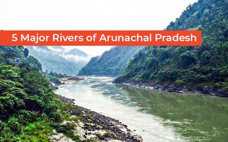
Rivers in Arunachal Pradesh vary from region to region. Some rivers are crystal clear, some are like a painted canvas of turquoise-blue and emerald-green. The state has unlimited sources of natural lakes, underground water, and rivers, with some contributing as tributaries to larger rivers such as the Brahmaputra. Brahmaputra river is the 9th largest river by discharge and the 15th longest in the world. The rivers in Arunachal Pradesh serve as part of its tributaries.
The five major rivers of Arunachal Pradesh
The Kameng River is about 284 kilometres (164
m) long. Its drainage basin is about 11,843 square kilometres (4,573 sq mi). At an elevation of
6,300 metres (20,667 feet), on the India-Tibet border, the Kameng River begins
from the glacial lake beneath the snow-capped Gori Chen peak in Tawang
District. It then flows through the Bhalukpong Circle of West Kameng District
in Arunachal Pradesh and to Sonitpur District of Assam, India. It is one of the
largest tributaries of the Brahmaputra River, joining it at Tezpur, to the east
of the KoliaBhomoraSetu bridge.
East Kameng District and West Kameng District are separated by the Kameng River, which also serves as a border between Sessa and Eaglenest Sanctuary to its west and the Pakke Tiger Reserve to its east. East and west of the Kameng River, respectively, lie the Dafla Hills and the Aka Hills.
The total length of the river is 2677 km. The river originates in Eastern Tibet's TirapPhasi Ranges before entering India and flowing through Kibithoo, a small town in Mishmi Hills of Anjaw District, following which it moves in the direction of the Lohit district and later merges into the Brahmaputra as one of the major tributaries.
Lohit River also holds a religious significance related to Hindu mythology. According to myth, Sage Parshuram after committing the crime of assassinating his mother had washed his sins in the pure water of the Lohit River. Hence, there is a Hindu pilgrimage site known as ParshuramKund set up along the banks of the Lohit River in the Lohit District where thousands of devotees visit each year on Makar Sankranti, to get a dip and wash their sins away. The site is very windy and cold even on hot days and is also one of the popular tourist destinations.
The Subansiri is 442 kilometres (275 miles) long, with a drainage basin of 32.640 square kilometres (12,600 sq miles) large. Its measured discharge varied between 131 m3/s (4,600 cu ft/s) and 18,799 m3/s (663,900 cu ft/s), with 18,799 m3/s serving as the maximum discharge. After leaving its origin in Tibet, the Subansiri River enters Arunachal Pradesh at Longju and then flows through the Upper Subansiri district. It travels east, southeast, and then south as it makes its way into the Assam Valley until it meets the Brahmaputra River in the Lakhimpur district.
The district Tirap derived its name from the
River Tirap, which originates from a high peak in the Laju Circle of Arunachal
Pradesh. The river flows from the southeast to the northeast part of the Tirap
district, then turns north and crosses over to Changlang district, and finally
joins the Buri-Dihing river near MounglangKhamti village of Ledo area. It has
several tributaries such as the Tisa, the Taken, the Tiking, the Tisingju, and
Tewai, and most of the tributaries of the Tirap rivers in the Tirap district
flow east to west.
Trivia: Except for the Tirap River, all the rivers in Arunachal Pradesh are snow-fed rivers.
Disclaimer: The opinions expressed in this article are those of the author's. They do not purport to reflect the opinions or views of The Critical Script or its editor.

Newsletter!!!
Subscribe to our weekly Newsletter and stay tuned.


Related Comments