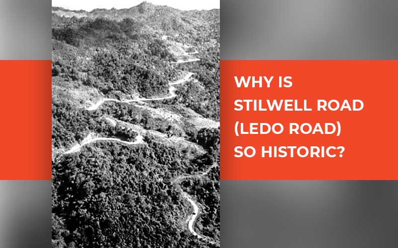
Built by the Allied Soldiers led by America during the Second
World War, the 1726 Km long Stilwell’s
Road has a deep history. It was first known as the "Ledo Road" and
was built directly under the direction of American General Joseph Warren
Stilwell before being renamed in the early months of 1945 at the advice of
Generalissimo Chaing Kai-shek. The road began from Ledo, Assam (one of the
railheads of the Bengal-Assam Railway in the Upper Brahmaputra Valley) and
continued to the Burma Road, which connected to Kunming, China. On the border
between India and Burma (now Myanmar), it travels through Lekhapani, Jairampur,
Nmampong, and the Pangsau Pass. It extends to Mitkyina by ascending the passes
of the Patkai Range, which rises to a height of 9,001 feet, and also extends
across the Upper Chindwin, entwining through the Hukawng and Mogaung valleys,
and descending to Bhamo,
eventually joining the Burma Road. Due to neglect, a large portion of the route
has sustained significant damage over time; however, some of it has been and/or
is being repaired.
General Joseph
Warren Stilwell (1883-1946)
Popularly known as “Vinegar Joe”, and known to his troops as “Uncle Joe," the Allied forces in the
China-Burma-India (CBI) theatre were led by General Stilwell as they defended
Burma (Myanmar) against Japanese forces. Technically, Generalissimo Chaing
Kai-shek was the Supreme Commander of the Allied Forces in China, as well as in
any areas of Indo-China (modern-day Vietnam) and Siam (modern-day Thailand)
that might become accessible to the troops. However, in 1943, Admiral Lord
Mountbatten took over as the Supreme Allied Commander of South-East Asian
forces. In addition, Stilwell was given the position of Deputy Supreme Allied
Commander for forces in Southeast Asia at that time.
Brief Background of Stilwell Road
Initially, the British proposed the idea of a road after prospecting
the Patkai Range for a route from Assam to northern Burma (Myanmar). It was
finally initiated in 1942 after the Japanese had completely taken over Burma
(Myanmar). The strategic situation had become serious as communication
connections from India to Allied Forces in Burma and the land route for
supplies to Chinese forces battling the Japanese in China were both shut. The
topography of the Indo-Burma border was tough, with dense, impassable woods
afflicted with Malaria and Dysentery. The only remaining method of getting
supplies into China was by air, which required flying around Japanese fighters
stationed in north Burma by taking a detour over the eastern Himalayas, or
"the Hump." Building a land route became crucial since both the required
altitude and the distance had an impact on fuel consumption and greatly reduced
the number of supplies that could be carried to China. The faltering Chinese
army of Generalissimo Chiang Kai-shek was being supplied through the final
significant land routes when Japanese forces invaded Burma in the spring of
1942.
Due to the fact that China's forces kept tens of thousands of
Japanese soldiers busy, the United States and its allies desperately needed to
maintain China in the conflict. By retaining control of that important Chinese
territory, the Allies were able to strike the Axis powers in the European
theatre while also constructing the required launch pad for an attack on
Japan's home islands. The ability to regularly supply China and its allies with
troops would be necessary for that grand strategy to succeed. Lieutenant
Colonel Frank D. Merrill, General Stilwell's operations officer, suggested
building a road connecting the old Burma Road from Ledo, Assam, India to Burma
in order to provide a land supply route into Burma for the support of the
Allied troops battling the Japanese forces in North Burma and China.
At Ledo, base roads, warehouses, hospitals, and barracks were
built alongside Japanese personnel when road work got underway in December
1942. The double-track, all-weather Ledo road was being constructed by the
Allies as of December 16, 1942. The Americans then transported large pieces of
heavy equipment for building roads, such as bulldozers, cranes, power shovels,
Caterpillars, and steamrollers, to these rugged highlands, travelling 12,000
miles across two oceans and three continents. The road reached Shindbwiyang on
December 27, 1943, three days before the scheduled expected date. The 117 miles
from Ledo to Shindbwiyang were open before January 1, 1944, as desired by
General Stilwell, but final grading and gravelling still needed to be done. No
necessities were left out of Colonel Pick's celebration for the engineers. They
had completed 54 miles in 57 days.
Even though some of the Ledo Road (Stilwell Road) needed to be
repaired due to heavy monsoon water after Myitkyina at the end of 1944, less
than two years after Stilwell accepted responsibility for its construction, it
connected to Burma Road and became a highway that stretched 1,079 miles from
Assam, India to Kunming, China. General Pick led the first convoy of 113 cars
from Ledo on January 12, 1945, and it arrived in Kunming, China, on February 4
of that same year.
To reduce the amount of petroleum transported by road and air
from Assam, India, to China, two 4-inch fuel pipelines were installed side by
side and followed along the Ledo route from Tinsukia, Assam. They were supplied
with fuel that was pumped from Calcutta to a station close to where they had
started.
The Ledo road was finally finished on May 20, 1945, and recently
promoted Major General Lewis A. Pick declared it to be the hardest work the US
Army Engineers had ever been given during the War. The road was originally
known as "Pick's Pike" to the engineers who built it until being
renamed the Stilwell Road in honour of General Joseph W. Stilwell at Chiang
Kai-Shek's recommendation.
The cost of building the road was anticipated to be $137,000,000.
Stilwell Road Legacy and Significance
Since the Stilwell Road passed through the territory of three
distinct countries—China, Burma, and India—and was not maintained by any of the
countries, it nearly disintegrated over time. The route is located in China at
632 km, Burma (Myanmar) at 1,033 km, and India at 61 km. In India, out of 61
km, 31 km is in Arunachal Pradesh and 30 km is in Assam. The restoration of
this road as a commercial route will promote greater neighbourly engagement and
sustain harmonious relations among the nations and reopening as an
international highway for a commercial corridor to connect China, Myanmar
(Burma), and other Southeast Asian nations can be a significant international
commercial hub.
Due to the roads' historical significance and fame from the
Second World War, it will also increase trade and draw domestic and foreign
tourists, which will help with socio-economic development in underdeveloped
border regions and benefit the locals. In and around Assam, Arunachal Pradesh,
north Myanmar (Burma), and southwest China in the China-Burma-India (CBI)
theatre, crashed Air Transport plane remnants from the war era are still
occasionally discovered.


Related Comments